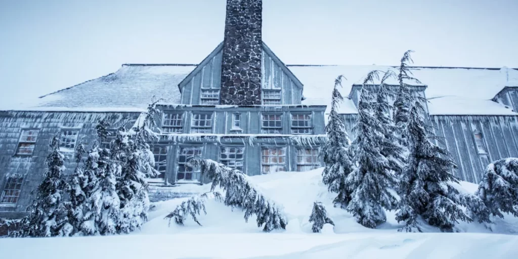
One state has already declared an emergency due to the approaching winter storm. Several affected states have also issued guidelines on how to stay safe during this period.
On January 21, 2025, the National Weather Service (NWS) issued a winter storm warning for nine U.S. states. The affected states include Alabama (AL), South Carolina (SC), North Carolina (NC), Georgia (GA), Louisiana (LA), Mississippi (MS), Florida (FL), Texas (TX), and Alaska (AK). Below is a breakdown of the affected areas in each state, the expected duration of the storm, and other important details.
Louisiana Areas Affected by the Winter Storm Warning
For Louisiana, the Lake Charles NWS reported that the affected areas include portions of central, south-central, southwest, and west-central Louisiana, as well as southeast Texas.
Winter storm warning duration: In effect until 9 p.m. CST.
What residents should anticipate: Heavy snowfall with additional accumulations ranging between one and six inches.
Precautions to be taken: Residents are urged to carry extra food, flashlights, and water in their cars in case of emergencies if travel is necessary. However, they are strongly advised to delay all travel. Extreme caution should be exercised if travel is unavoidable. Road condition updates can be obtained by dialing 511.
People are encouraged to stay indoors until weather conditions improve. If going outside, they should dress in layers, including gloves, scarves, and hats, to stay warm. All exposed skin should be covered to reduce the risk of hypothermia or frostbite.
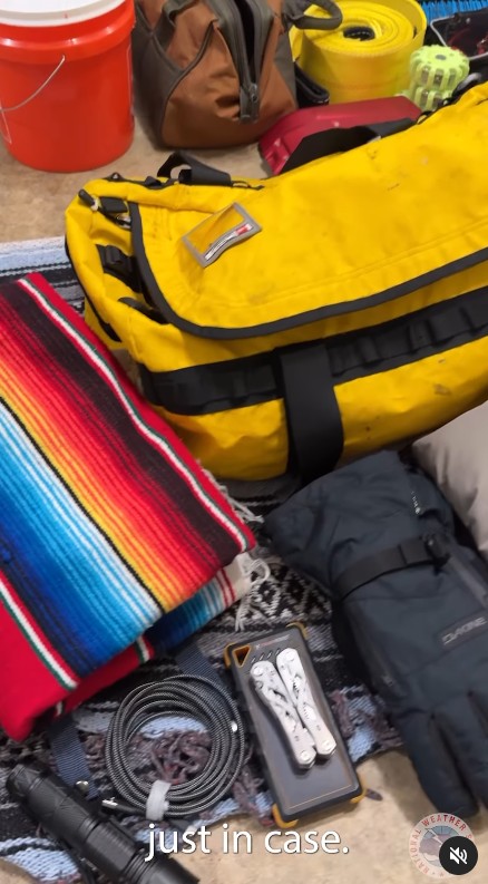
Some essentials to pack if driving through the winter storm in a post dated January 5, 2025 | Source: Instagram/nws
The New Orleans NWS also reported that portions of southeast Louisiana and southern Mississippi need to be on high alert.
Winter storm warning duration: In effect until midnight CST.
What residents should anticipate: Moderate to heavy snowfall with total snow and sleet accumulation ranging between three and seven inches. Ice accumulations are expected to be a light glaze.
Precautions to be taken: Residents are urged to carry extra food, flashlights, and water in their cars in case of emergencies if travel is necessary. However, they are strongly advised to delay all travel. Extreme caution should be exercised if travel is unavoidable. Road condition updates can be obtained by dialing 511.
People are encouraged to stay indoors until weather conditions improve. If going outside, they should dress in layers, including gloves, scarves, and hats, to stay warm. All exposed skin should be covered to reduce the risk of hypothermia or frostbite.
The same NWS also issued warnings for the following areas: Coastal Jefferson Parish, Lower Lafourche, Lower Plaquemines, and Lower Terrebonne Parishes.
Winter storm warning duration: In effect until midnight CST.
What residents should anticipate: Heavy mixed precipitation.
Precautions to be taken: Residents are urged to carry extra food, flashlights, and water in their cars in case of emergencies if travel is necessary. However, they are strongly advised to delay all travel. Extreme caution should be exercised if travel is unavoidable. Road condition updates can be obtained by dialing 511.
People are encouraged to stay indoors until weather conditions improve. If going outside, they should dress in layers, including gloves, scarves, and hats, to stay warm. All exposed skin should be covered to reduce the risk of hypothermia or frostbite.
North Carolina Areas Affected by the Winter Storm Warning
According to the Newport/Morehead City NWS, the affected areas in North Carolina include Carteret, southern Craven, Pamlico, Tyrrell, and Hyde counties, including Dare County and the Outer Banks.
Winter storm warning duration: From 5 p.m. until 7 a.m. EST on Wednesday.
What residents should anticipate: Heavy snowfall with a total accumulation of between four and six inches.
Precautions to be taken: Residents are urged to carry extra food, flashlights, and water in their cars in case of emergencies if travel is necessary. However, they are strongly advised to delay all travel. Extreme caution should be exercised if travel is unavoidable. Road condition updates can be obtained by dialing 511.
People are encouraged to stay indoors until weather conditions improve. If going outside, they should dress in layers, including gloves, scarves, and hats, to stay warm. All exposed skin should be covered to reduce the risk of hypothermia or frostbite.
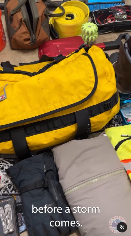
Some essentials to pack if driving through the winter storm in a post dated January 5, 2025 | Source: Instagram/nws
The NWS also noted that Onslow, Jones, northern Craven, Beaufort, and Washington counties should be on high alert.
Winter storm warning duration: From 5 p.m. on Tuesday until 7 a.m. EST on Wednesday.
What residents should anticipate: Heavy snowfall with total accumulation between two and four inches.
Precautions to be taken: Residents are urged to carry extra food, flashlights, and water in their cars in case of emergencies if travel is necessary. However, they are strongly advised to delay all travel. Extreme caution should be exercised if travel is unavoidable. Road condition updates can be obtained by dialing 511.
People are encouraged to stay indoors until weather conditions improve. If going outside, they should dress in layers, including gloves, scarves, and hats, to stay warm. All exposed skin should be covered to reduce the risk of hypothermia or frostbite.
Duplin and Lenoir counties are also expected to be affected.
Winter storm warning duration: From 5 p.m. until 7 a.m. EST on Wednesday.
What residents should anticipate: Heavy snowfall with total accumulation reaching up to six inches.
Precautions to be taken: Residents are urged to carry extra food, flashlights, and water in their cars in case of emergencies if travel is necessary. However, they are strongly advised to delay all travel. Extreme caution should be exercised if travel is unavoidable. Road condition updates can be obtained by dialing 511.
People are encouraged to stay indoors until weather conditions improve. If going outside, they should dress in layers, including gloves, scarves, and hats, to stay warm. All exposed skin should be covered to reduce the risk of hypothermia or frostbite.
The Wilmington NWS has reported that portions of southeast North Carolina and northeast South Carolina will also be affected.
Winter storm warning duration: From 9 p.m. until 8 a.m. EST on Wednesday.
What residents should anticipate: Snow accumulation up to three inches, with locally higher amounts possible.
Precautions to be taken: Residents are urged to carry extra food, flashlights, and water in their cars in case of emergencies if travel is necessary. However, they are strongly advised to delay all travel. Extreme caution should be exercised if travel is unavoidable. Road condition updates can be obtained by dialing 511.
People are encouraged to stay indoors until weather conditions improve. If going outside, they should dress in layers, including gloves, scarves, and hats, to stay warm. All exposed skin should be covered to reduce the risk of hypothermia or frostbite.
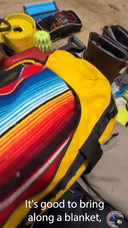
Some essentials to pack if driving through the winter storm in a post dated January 5, 2025 | Source: Instagram/nws
South Carolina Areas Affected by the Winter Storm Warning
According to the Charleston NWS, the affected areas in South Carolina include parts of Georgia such as Bulloch, Candler, Effingham, Evans, Jenkins, Screven, and Tattnall counties. The affected areas in South Carolina include Allendale, Beaufort, Charleston, and several inland and coastal counties.
Winter storm warning duration: From 5 p.m. until noon EST on Wednesday.
What residents should anticipate: Heavy snowfall with accumulations reaching up to two inches.
Precautions to be taken: Same as Louisiana, but residents are advised to include booster cables, shovels, tire chains, extra clothing, blankets, and a first-aid kit in their winter storm kits.
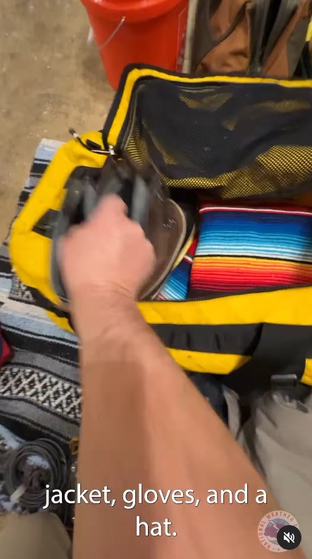
Some essentials to pack if driving through the winter storm in a post dated January 5, 2025 | Source: Instagram/nws
Other areas mentioned include: Coastal and Inland Bryan, Coastal and Inland Chatham, Coastal and Inland Liberty, Coastal and Inland McIntosh, and Long Counties.
Winter storm warning duration: From 5 p.m. Tuesday until noon EST on Wednesday.
What residents should anticipate: Heavy mixed precipitation, with snow and sleet accumulations reaching up to one inch and ice accumulations of up to one-quarter of an inch.
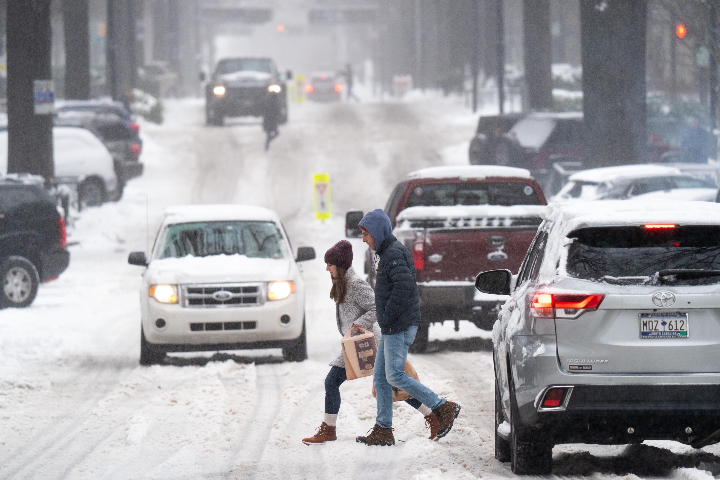
Pedestrians cross a street as motorists drive through the snow on January 16, 2022, in Greenville, South Carolina | Source: Getty Images
Precautions to be taken: Residents are urged to carry extra food, flashlights, and water in their cars in case of emergencies if travel is necessary. However, they are strongly advised to delay all travel. Extreme caution should be exercised if travel is unavoidable. Road condition updates can be obtained by dialing 511.
People are encouraged to stay indoors until weather conditions improve. If going outside, they should dress in layers, including gloves, scarves, and hats, to stay warm. All exposed skin should be covered to reduce the risk of hypothermia or frostbite.
Texas Areas Affected by the Winter Storm Warning
According to the Austin/San Antonio NWS, the affected areas in Texas include the I-35 Corridor and the Coastal Plains.
Winter storm warning duration: In effect until 6 p.m. CST over the I-35 Corridor and Coastal Plains.
What residents should anticipate: Heavy mixed precipitation with total snowfall and sleet accumulations of up to one and a half inches. Ice accumulations may reach up to one-tenth of an inch.
Precautions to be taken: Residents are urged to carry extra food, flashlights, and water in their cars in case of emergencies if travel is necessary. However, they are strongly advised to delay all travel. Extreme caution should be exercised if travel is unavoidable. Road condition updates can be obtained by dialing 511.
People are encouraged to stay indoors until weather conditions improve. If going outside, they should dress in layers, including gloves, scarves, and hats, to stay warm. All exposed skin should be covered to reduce the risk of hypothermia or frostbite. Road condition updates can be obtained by dialing 800-452-9292 or visiting drivetexas.org.
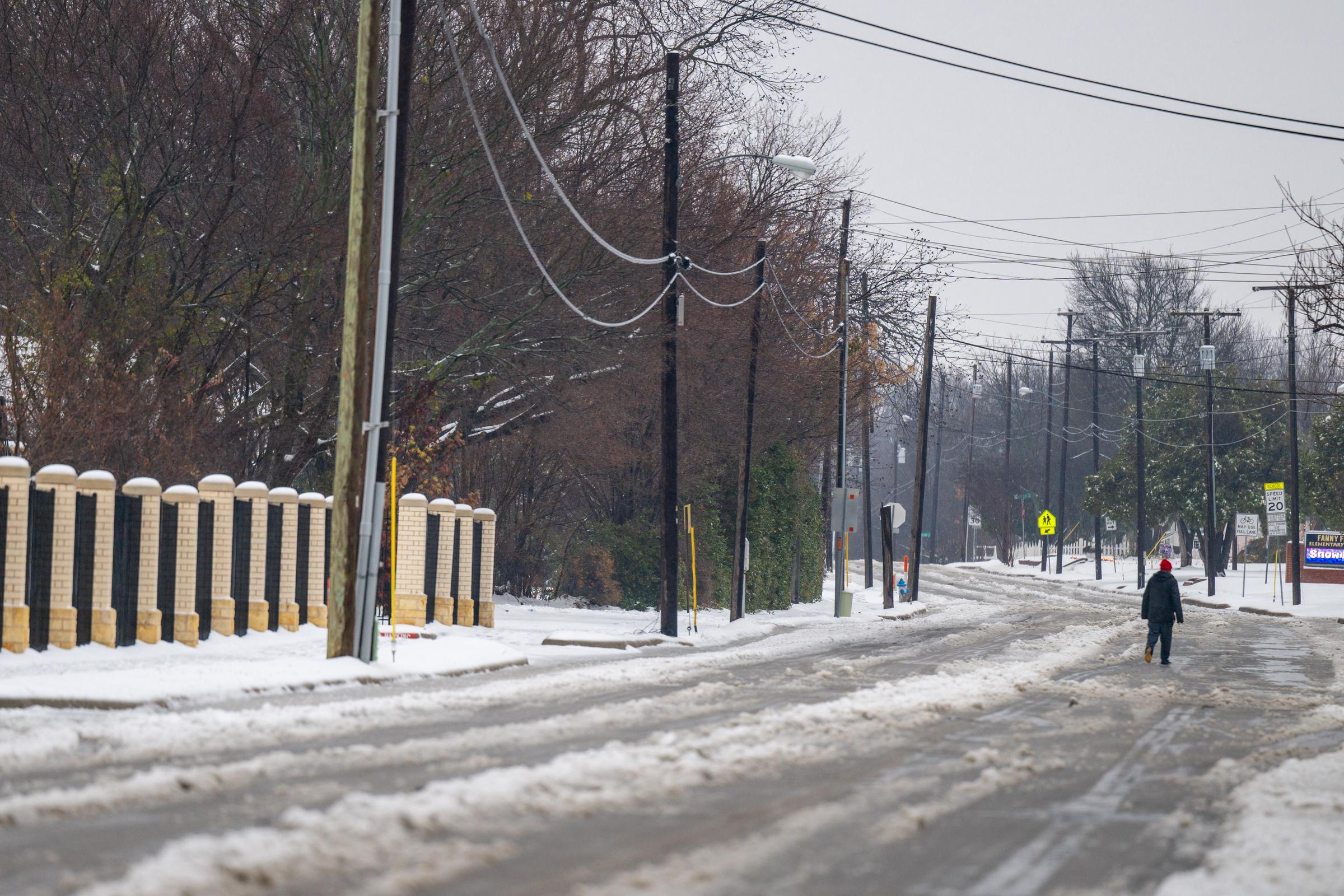
The street during a winter storm on January 9, 2025, in Plano, Texas | Source: Getty Images
According to the Houston/Galveston NWS, portions of south, central, and southeast Texas will be affected.
Winter storm warning duration: In effect until 6 p.m. CST on Tuesday.
What residents should anticipate: Heavy snow and sleet from late Monday night until early Tuesday afternoon, with exact locations uncertain. Localized accumulations may exceed five inches. Additional accumulations between two and four inches are expected. Winds may reach up to 40 mph.
Precautions to be taken: Residents are advised to delay all travel if possible. If travel is necessary, drive cautiously and be prepared for sudden changes in visibility. Maintain a safe distance from other vehicles, allow extra travel time, and avoid sudden braking or acceleration.
Florida Areas Affected by the Winter Storm Warning
According to the Jacksonville NWS, portions of southeast Georgia will be affected.
Winter storm warning duration: In effect from 4 p.m. until 1 p.m. EST on Wednesday.
What residents should anticipate: Heavy mixed precipitation with total snowfall and sleet accumulations of up to two inches. Ice accumulations may reach up to one-tenth of an inch.
Precautions to be taken: Residents are urged to carry extra food, flashlights, and water in their cars in case of emergencies if travel is necessary. However, they are strongly advised to delay all travel. Extreme caution should be exercised if travel is unavoidable. Road condition updates can be obtained by dialing 511.
People are encouraged to stay indoors until weather conditions improve. If going outside, they should dress in layers, including gloves, scarves, and hats, to stay warm. All exposed skin should be covered to reduce the risk of hypothermia or frostbite.

Some essentials to pack if driving through the winter storm in a post dated January 5, 2025 | Source: Instagram/nws
Other areas mentioned include Coastal Nassau and Trout River counties, which should remain on high alert.
Winter storm warning duration: In effect from 7 p.m. until 1 p.m. EST on Wednesday.
What residents should anticipate: Heavy mixed precipitation, with total snowfall and sleet accumulations reaching up to one-half inch and ice accumulations of up to one-tenth of an inch.
Precautions to be taken: Residents are urged to carry extra food, flashlights, and water in their cars in case of emergencies if travel is necessary. However, they are strongly advised to delay all travel. Extreme caution should be exercised if travel is unavoidable. Road condition updates can be obtained by dialing 511.
People are encouraged to stay indoors until weather conditions improve. If going outside, they should dress in layers, including gloves, scarves, and hats, to stay warm. All exposed skin should be covered to reduce the risk of hypothermia or frostbite.
Alabama Areas Affected by the Winter Storm Warning
According to the Birmingham NWS, the affected areas include Barbour, Bullock, Lee, Lowndes, Macon, Montgomery, Pike, and Russell counties.
Winter storm warning duration: In effect from 6 a.m. Tuesday until 6 a.m. CST on Wednesday.
What residents should anticipate: Heavy snow with total snowfall and sleet accumulations of up to three inches.
Precautions to be taken: Residents are urged to carry extra food, flashlights, and water in their cars in case of emergencies if travel is necessary. However, they are strongly advised to delay all travel. Extreme caution should be exercised if travel is unavoidable. Road condition updates can be obtained by dialing 511.
People are encouraged to stay indoors until weather conditions improve. If going outside, they should dress in layers, including gloves, scarves, and hats, to stay warm. All exposed skin should be covered to reduce the risk of hypothermia or frostbite.
Mississippi Areas Affected by the Winter Storm Warning
According to the Jackson NWS, portions of northeast Louisiana and southern Mississippi will be affected.
Winter storm warning duration: In effect until midnight CST on Tuesday.
What residents should anticipate: Heavy snow with total accumulations of up to four inches.
Precautions to be taken: Residents are urged to carry extra food, flashlights, and water in their cars in case of emergencies if travel is necessary. However, they are strongly advised to delay all travel. Extreme caution should be exercised if travel is unavoidable. Road condition updates can be obtained by dialing 511.
People are encouraged to stay indoors until weather conditions improve. If going outside, they should dress in layers, including gloves, scarves, and hats, to stay warm. All exposed skin should be covered to reduce the risk of hypothermia or frostbite.
Alaska Areas Affected by the Winter Storm Warning
According to the Fairbanks NWS, the affected areas include Eastern Norton Sound, Nulato Hills, Yukon Delta Coast, Lower Yukon River, Middle Yukon Valley, Lower Yukon, and Innoko Valleys.
Winter storm warning duration: In effect from 9 p.m. until 6 a.m. AKST on Wednesday.
What residents should anticipate: Heavy snow with total accumulations of six to ten inches. Near-blizzard conditions could occur overnight from Scammon Bay to Chevak.
Precautions to be taken: Travel may be difficult or impossible.
Additional areas affected include the Southern Seward Peninsula Coast and the Interior Seward Peninsula.
Winter storm warning duration: In effect from midnight on Tuesday until 6 p.m. AKST on Wednesday.
What residents should anticipate: Heavy snow with accumulations of six to twelve inches. Visibility may be reduced to one-half mile due to gusty winds up to 35 mph.
Prautions to be taken: Residents are urged to carry extra food, flashlights, and water in their cars in case of emergencies if travel is necessary. However, they are strongly advised to delay all travel. Extreme caution should be exercised if travel is unavoidable. Road condition updates can be obtained by dialing 511.
People are encouraged to stay indoors until weather conditions improve. If going outside, they should dress in layers, including gloves, scarves, and hats, to stay warm. All exposed skin should be covered to reduce the risk of hypothermia or frostbite.
Georgia Areas Affected by the Winter Storm Warning
According to the Peachtree City NWS, parts of central, east-central, southeast, and west-central Georgia will be affected.
Winter storm warning duration: In effect from 10 a.m. on Tuesday until 7 a.m. EST on Wednesday.
What residents should anticipate: Heavy snow with mixed precipitation and total accumulations of up to two inches, with a light glaze of ice
